
Parowan Gap is listed on the National Register of Historic Places, identifying it as a place worthy of protection for future generations.
This item is available in full to subscribers.
To continue reading, you will need to either log in to your subscriber account, or purchase a new subscription.
If you are a current print subscriber, you can set up a free website account and connect your subscription to it by clicking here.
If you are a digital subscriber with an active, online-only subscription then you already have an account here. Just reset your password if you've not yet logged in to your account on this new site.
Otherwise, click here to view your options for subscribing.
Please log in to continue |
Story by Phil Clark
Lake Powell Chronicle
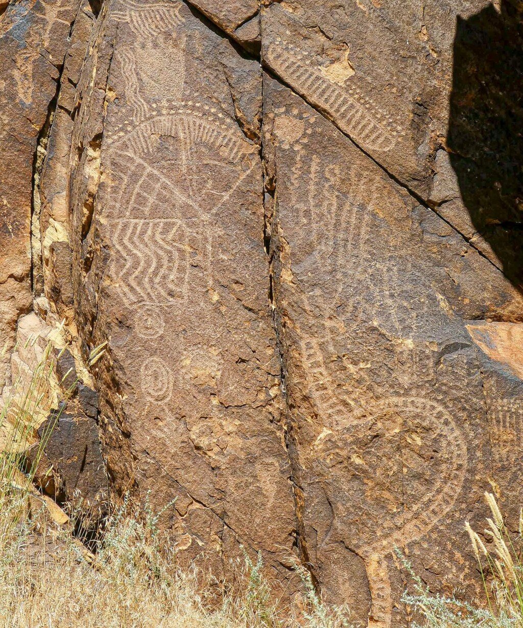
Archeologists believe that 1,500 years ago, Fremont, Hopi, and Paiute Natives created petroglyphs on the cliffs at Parowan Gap, about 20 miles north of Cedar City, Utah.
During a recent trip, my wife and I visited the Gap as part of our visit to Cedar City and to Cedar Breaks National Monument.
At the Gap, the rocks soon revealed their secrets. We spent an hour walking on the walkways along the road admiring the myriad petroglyphs on the huge boulders and rocks. Ancient Native Americans created petroglyphs by pecking and scratching the top layer of brown desert varnish. The removed varnish reveals a lighter colored Navajo Sandstone underneath. The more we looked, the more petroglyphs we saw with a huge variety of images. As we followed walkways next to the highway, we were mindful of the traffic, whizzing by oblivious to the beauty and history we were experiencing. Luckily there weren’t that many cars.
As we looked closer, we realized the images included those of geometric shapes, lizards, snakes, mountain sheep, bear claws, and human-like anthropomorphism. One of the best-known petroglyphs presents itself as a large “V” and is referred to as the “Zipper Glyph.” According to the Bureau of Land Management, a Paiute tribal member in 1940 told a newspaper editor that the Zipper Glyph illustrated a map of travels with marks indicating the time spent along the route. In 1990, two archeologists studied the area extensively and suggested that the Zipper, with its regular marks along each side of the V, represented markers for a sun and a moon that would correspond to the four seasons. For example, the sun sets at the middle of the V at summer solstice. Further study revealed nearby ancient cairns and rock markers corresponding with equinoxes, cross quarters, and other annual solar events. Markings for the seasons would allow early inhabitants to plant and harvest crops during appropriate seasons and know when to prepare for the winter cold.
Parowan Gap is listed on the National Register of Historic Places, identifying it as a place worthy of protection for future generations. Some liken the site to Stonehenge in its significance. It is managed by the BLM. And there are some visitor facilities such as a shade structure, tables, benches and a restroom. There is no water available though and visitors must bring their own.
The BLM has partnered with the Paiute Indian Tribe of Utah, the Hopi Tribe, Cedar City and Brian Head Tourism Bureau to protect the site and provide visitor information. The site is open year-round and there is no fee to visit the site. Visitors are simply asked to enjoy the area and treat the area with respect. If the site is damaged in any way, the history is lost forever, denying future generations the opportunity to appreciate the site’s significance. Information: https://www.blm.gov/visit/parowan-gap


