
Michael Berry, park engineer for Glen Canyon National Recreation Area and Rainbow Bridge National Monument, presented research on the history of Lake Powell access in the Wahweap and Stateline areas at the monthly Canyon Club meeting in Page on June 17.
This item is available in full to subscribers.
To continue reading, you will need to either log in to your subscriber account, or purchase a new subscription.
If you are a current print subscriber, you can set up a free website account and connect your subscription to it by clicking here.
If you are a digital subscriber with an active, online-only subscription then you already have an account here. Just reset your password if you've not yet logged in to your account on this new site.
Otherwise, click here to view your options for subscribing.
Please log in to continue |
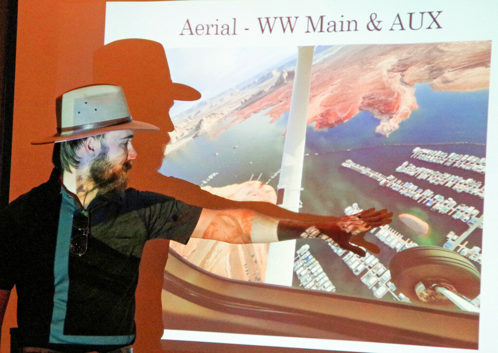
Michael Berry, park engineer for Glen Canyon National Recreation Area and Rainbow Bridge National Monument, presented research on the history of Lake Powell access in the Wahweap and Stateline areas at the monthly Canyon Club meeting in Page on June 17.
Berry moved to Page from Australia because he loves the area and has wanted to live here for a long time. His wife and two children have been exploring their new backyard, both on and off the water. He has been keeping busy with the challenges of low water at Lake Powell.
Berry started by reminding the audience that the National Park Service does not have control over the rise and fall of the lake level. The managers at Glen Canyon NRA are often forced to manage in a reactive way. The Bureau of Reclamation’s annual projections are crucial to the planning for facilities in the future, but they are only predictions and change over time.
It took from 1963 to 1980 for Lake Powell to come to full pool of 3,700 feet. The last 20 years have been the driest in the past 100 years, and the current water levels haven’t existed since the 1960s when the lake was rising every year. The receding lake levels have uncovered some of the original boat launch and lake access ramps that were used before Glen Canyon National Recreation Area was established in 1972 and well before the lake came to full pool.
Focusing downlake, as the Wahweap/Stateline/Antelope Point areas are called, Berry showed historic photos from the 1960s and 1970s and commented that not only did the traffic seem a bit disorganized back then, but also there were so many cab-over campers and small trailers. Recreation has changed a lot since then then.
Berry said the expected low water level in spring 2023 is 3,505 feet, about 15 feet above the level at which power generation is no longer possible. As managers plan for this possible scenario, Glen Canyon NRA has hired an underwater scanning service to create a three-dimensional bathymetric map of the land below the water level. This information, coupled with the bureau predictions, will allow the NPS to plan ahead and keep up with the lake levels.
Berry showed historic drawings and photographs of the five ramps that existed when the lake filled. Four of them were used before the current main Wahweap Ramp was opened. Berry remarked that some people wonder why the main Wahweap Ramp cannot be extended any farther, and he presented survey data showing how fast the ground drops off below the existing ramp. The audience enjoyed seeing the historic photos.
The original ramp at the newly constructed Stateline Auxiliary/Legacy ramp consisted of military matting covered with light asphalt concrete. The new concrete ramp is expected to be able to be extended to 3,450 feet, when it will likely come to the edge of Wahweap Canyon. Berry made it clear that they are only planning ahead, just in case, and not expecting the lake to drop that low.
“This ramp will be the lifeline (to the lake),” he said.
According to the Canyon Club of Page website, “The purpose of the Canyon Club is to actively pursue improvements to the community in which we live. Through our involvement in our community we will create an atmosphere where local citizens can participate in activities that will enrich their lives and the lives of those living in this community.”
The Canyon Club is a nonprofit organization. Those interested in joining or attending the monthly presentations should contact the Canyon Club at YourFriends@PageCanyonClub.org.


